John Tully Maps
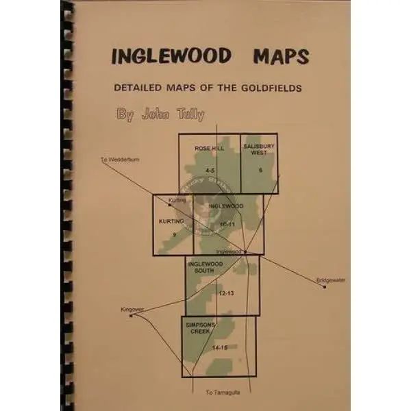
Map, John Tully Inglewood
Map, John Tully Inglewood
Couldn't load pickup availability
Your Must-Have Maps for Gold Prospecting
Discover the rich history and hidden treasures of the Castlemaine goldfield with this meticulously researched set of fine-detailed maps.
🔍 Extensive Research: Compiled from early survey maps, Mines Department records, contemporary newspaper articles, interviews with local identities, and personal observation.
🗺️ Detailed Coverage: Highlights private and public land, current roads, bush tracks, dams, alluvial gold workings, reef mines, and places of historic interest.
🚗 Accessible Roads: All roads shown have been driven down in a standard vehicle by the author. Note: Some bush tracks may not be suitable for 2WD vehicles in all seasons.
🧭 Magnetic North: Maps are oriented to magnetic north, aiding navigation.
Disclaimer: Be aware that bush tracks and their names can change. Permission may be required for some activities or access to public land.
Whether you're a seasoned prospector or a history enthusiast, these maps are an invaluable resource for exploring the rich heritage and gold-bearing potential of the region. Dive into the world of gold prospecting with confidence and discover treasures hidden within these historic lands. Let John Tully's expertise guide you on your journey to uncover the secrets of Victoria's goldfields.
About the Author
John Tully arrived in Dunolly on a detecting holiday in 1980, found gold, and has lived there ever since. He has gained extensive knowledge about gold occurrence and the history of the area. John co-authored "A Difficult Case," a story about a Chinese miner, with Ruth Moore. This book was a runner-up for Best Victorian History Book in the Victorian Community History Awards 2001. Since 1989, John has been the President of the Goldfields Historical & Arts Society Inc (Dunolly Museum).
Share


